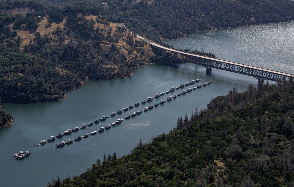
Lake Oroville Water Levels Before and After the Drought
On Dec. 9, 2014, Lake Oroville’s water level was just 649 feet out of Oroville’s dam capacity of about 900 feet. After engineers and the fate of nature worked together, Oroville lake levels reached normal levels in five years.
After a series of storms, California’s Lake Oroville reached a dangerous level of capacity that was both celebrated and dreaded. But why and how did the water levels get so low? Let’s get into it, and learn what Lake Oroville looks like today.
Where Is Lake Oroville? Water Levels and Location.
The location of Lake Oroville is in Butte County, which sits on the western slope of the Sierra Nevada. Lake Oroville is about 75 miles north of Sacramento. The reservoir is fed by the runoff from the forks of the Feather Rivers.

Source: European Union, Copernicus Sentinel/Wikicommons
According to the department of water resources it’s the second largest human-made reservoir in California and serves the Bay Area, the San Joaquin Valley, and some of Southern California. This California reservoir supplies 29 urban and agricultural water agencies. The largest reservoir in California is Shasta Lake.
How Did Lake Oroville Reach Historically Low Water Levels?
Between 2012 and 2016, California was experiencing the second-worst drought in the state’s history. The drought lasted five years and caused widespread water shortages, agricultural losses, and wildfires.

Source: George Rose/Getty Images
Lake Oroville lost a significant amount of water during the 2012–2016 drought due to reduced precipitation (below historical average), increased evapotranspiration, increased water demand, and challenging reservoir management.
How Low Did the Lake Oroville Water's Get?
In the fifth year of the drought, 90% of the state had been affected. Many of the reservoirs across the state had dried up.

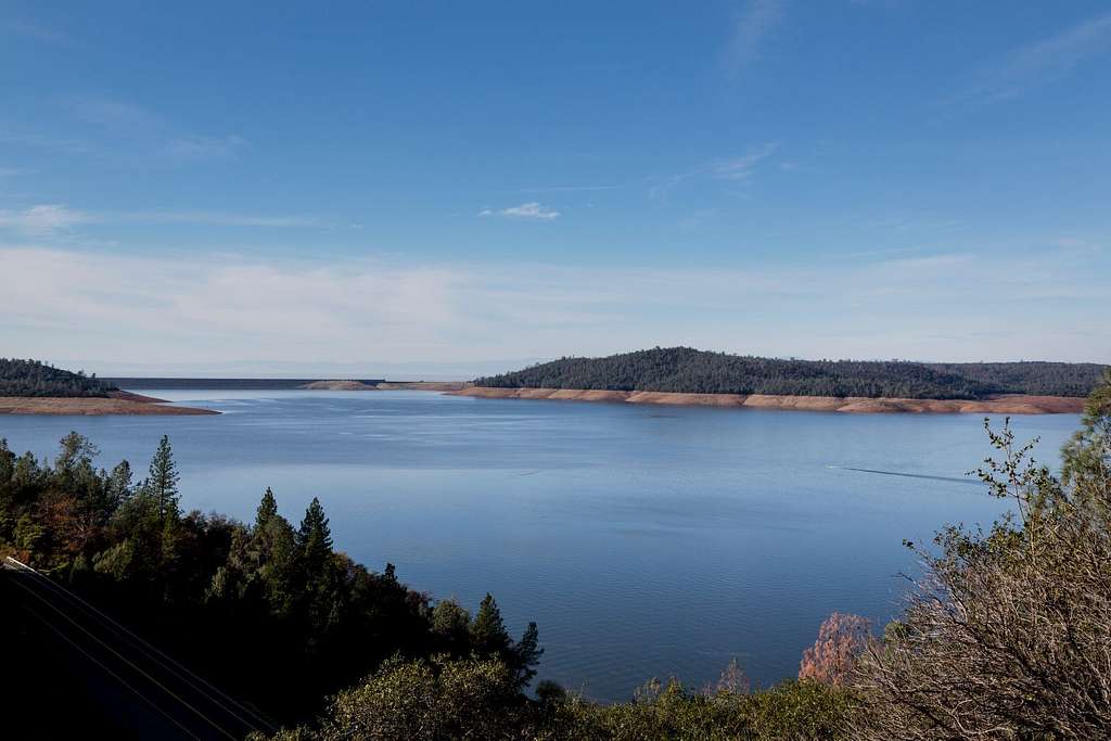
Source: Cynthia Mendoza/Flickr
Lake Oroville saw its level dip to historic lows. When it is full, the reservoir can hold 3.5 million acre-feet of water. The reservoir was at 32% of capacity in this photo from Aug. 19, 2023.
Lake Oroville After the Drought
Then, the El Nino storms, which were one of the strongest on record, brought significant impacts to California. This brought much-needed heavy rainfall, flooding, and coastal erosion to the parched land.

Source: George Rose/Getty Images
The lake levels in California quickly replenished thanks to the El Nino storms, despite it causing many mudslides and flooding across the state.
The Rapid Rising Water Levels Became Dangerous
On Feb. 7, dam operators noticed an unusual flow down the main spillway. The operators halted releases and saw that erosion had opened a crater in the main spillway. As the storm raged on, the crater grew and started to flow over the dam’s emergency spillway on Feb. 11.

Source: George Rose/Getty Images
As damage grew, the Butte County Sheriff’s Office initiated evacuation orders for nearly 200,000 residents.
How High Did the Water Levels Rise?
As a result of the storms, the water level of Lake Oroville rose rapidly, reaching its highest level in over a decade in March 2016.

Source: San Francisco Chronicle
This season’s storm caused an unprecedented increase in the reservoir, peaking in early February according to the Lake Oroville water level graph from The San Francisco Chronicle.
How Did California Engineers Help Maintain Lake Oroville's Water Levels?
The engineers were also to thank for the dramatic increase in the reservoir’s water levels. Embracing technological advancements — such as water conservation apps, exploring desalination technologies, and using smart sensors to collect real-time data on water usage — helped to enhance water management practices.

Source: Carol M. Highsmith's America Project, Library of Congress/GetArchive
The strategies applied by the engineers played a critical role in preserving water levels during the 2012–2016 drought and enhanced the state’s water resilience for future generations.
California Governor Warns the State’s Residents
The previous California Gov. Jerry Brown warned California residents that the El Nino storms are just temporary benefits.

Source: Jon Sullivan/Flickr
In 2015, Brown ordered that the state reduce its water consumption by 25%, and later signed an executive order to impose strict regulations on water conservation. For example, residents are no longer allowed to hose off their driveways or sidewalks. This is all in an effort to make a long-term resolution to future droughts.
The 2016 Drought Cost California Billions of Dollars
These measures might seem extreme to many, but the drought impacted the economy heavily. According to a 2021 report by the California Natural Resources Agency, the 2016 drought caused an estimated loss of $2.7 billion in agricultural production. This loss was primarily due to reduced crop yields and increased production costs.

Source: Ben Amstutz/Flickr
The National Oceanic and Atmospheric Administration (NOAA) predicts that California’s water levels will return to normal after several more years of above-average rainfall (via All That’s Interesting).
Why Are Droughts So Common in California?
California seems to constantly be battling droughts. With the most recent drought happening between 2020-2022, it’s not hard to wonder why California is seemingly always experiencing droughts.

Source: Shutter Theory/Flickr
Droughts are a common occurrence in California due to a combination of geographical, climatic, and human-induced factors, which include poor water management and high demand.
How to Prevent Droughts in California
There are ways to protect reservoirs’ water levels across the state of California. These include implementing sustainable water management, promoting water conservation, and adapting to changing climate conditions.

Source: Diego V/Flickr
While we can’t control the weather, we can do our part by making sure we are not wasting water on artificial projects that heavily rely on a scarce resource in California.
The California Department of Water and the State Water Project
The California State Water Project (SWP), spanning over 705 miles, is a vast and multifaceted water system that delivers water to 27 million Californians and irrigates 750,000 acres of farmland. The SWP plays a crucial role in addressing climate change challenges, managing water supplies during floods and droughts, and is a significant source of hydroelectric power, contributing to the state’s energy needs and environmental objectives.

